
New Zealand's South Island at a Glance: Key Facts Every Visitor Should Know

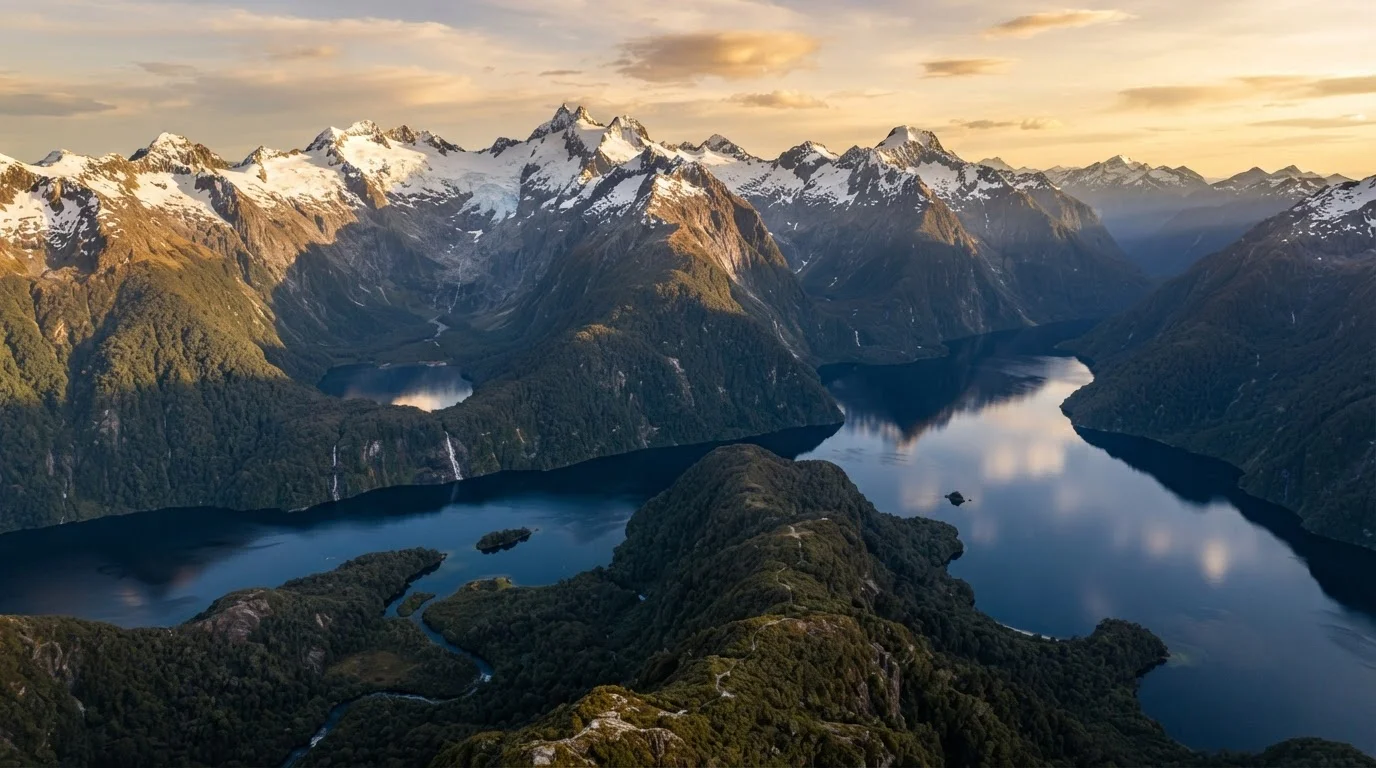
Photo: ArticleHood.com | Precision In Every Word editorial
What Makes the South Island Different
New Zealand's South Island - known in Māori as Te Waipounamu, meaning "the waters of greenstone" - is the country's largest landmass and one of the most geographically varied destinations in the Southern Hemisphere. Unlike the North Island's volcanic plateau and dense urban centres, the South Island is defined by the Southern Alps, a spine of peaks running nearly the full length of the island, flanked by glaciers to the west and rain-shadowed high-country basins to the east.
Most visitors enter through one of two main airports: Christchurch on the east coast (the island's largest city) or Queenstown in the south, which handles heavy international and domestic traffic year-round. A third entry point, Nelson, receives domestic flights and sits at the top of the island near the Marlborough Sounds.
| Total area | 150,437 km² (approx. 58,000 sq mi) (Statistics New Zealand) |
| Population | Approx. 1.1 million (Statistics New Zealand, 2023 estimate) |
| Highest peak | Aoraki/Mount Cook, 3,724 m (12,218 ft) (Land Information New Zealand) |
| Main entry airports | Christchurch (CHC), Queenstown (ZQN), Nelson (NSN) |
| North-to-south driving distance | Approx. 900 km (Picton to Invercargill) (NZ Transport Agency route estimates) |
| UNESCO World Heritage site | Te Wahipounamu (Southwest NZ), designated 1990 (UNESCO) |
| National parks | 10 national parks, including Fiordland and Kahurangi (Department of Conservation NZ) |
| Currency | New Zealand Dollar (NZD) |
Understanding the island's sheer scale before you arrive is essential. Driving from Picton in the north to Invercargill in the far south covers roughly 900 kilometres - and that's via the most direct inland route. Allow far more time than a map suggests: mountain passes, single-lane bridges, and scenic detours are simply part of the experience.
Regions, Climate, and What to Expect
The South Island divides neatly into distinct regional personalities, each with its own climate logic.
Te Waipounamu
The Māori name for the South Island, meaning 'the waters of greenstone.' It reflects both the island's rivers and the pounamu (greenstone/jade) found there, which holds deep cultural significance for Ngāi Tahu, the principal South Island iwi (tribe).
Southern Alps (Kā Tiritiri o te Moana)
The mountain range running almost the full length of the South Island, dividing the wetter west from the drier east. The range contains dozens of peaks over 3,000 metres and feeds most of the island's major rivers and glaciers.
DOC (Department of Conservation)
New Zealand's government agency responsible for managing national parks, tracks, huts, and campgrounds. DOC operates the Great Walks booking system and sets conservation guidelines visitors are expected to follow.
Rain shadow
A dry area on the leeward side of a mountain range, where moist air has already dropped its precipitation on the windward side. Canterbury and Central Otago sit in the Southern Alps' rain shadow, producing dramatically different climates from the West Coast just kilometres away.
Piopiotahi (Milford Sound)
A fiord in Fiordland National Park formed by glacial action, now one of New Zealand's most visited natural landmarks. It sits within the Te Wahipounamu UNESCO World Heritage Area and receives over a metre of rainfall per month on average.
Great Walks
A network of nine multi-day walking tracks designated by DOC as New Zealand's finest backcountry routes. The South Island hosts several, including the Milford Track, Kepler Track, and Abel Tasman Coast Track. Bookings are required for huts and campsites.
- Marlborough & Nelson (Top of the South): The sunniest corner of the island. Marlborough's flat river valleys produce most of New Zealand's export wine. Nelson draws artists, food producers, and beachgoers. Rainfall is low and summers are long and warm.
- West Coast (Te Tai o Poutini): A narrow strip between the Alps and the Tasman Sea. Receives some of the highest rainfall on Earth - over 5,000 mm annually in parts - but rewards visitors with ancient rainforests, glacier walks, and near-total solitude. Pack waterproof gear regardless of season.
- Canterbury: Christchurch anchors a wide agricultural plain. The Southern Alps rise abruptly to the west, and ski fields are accessible within 90 minutes of the city in winter. Arthur's Pass connects Canterbury to the West Coast via a dramatic mountain road.
- Queenstown-Lakes & Otago: Queenstown's reputation for adventure tourism precedes it - bungy jumping, skiing, and white-water rafting draw visitors across all seasons. The broader Otago region includes the Mackenzie Basin (home to Aoraki/Mount Cook, New Zealand's tallest peak at 3,724 m) and the remarkable landscapes around Wānaka.
- Southland & Fiordland: Te Anau is the gateway to Fiordland National Park and the Milford Sound / Piopiotahi, arguably the island's single most iconic sight. Expect cool temperatures and unpredictable weather. Invercargill, the southernmost city, also serves as a jump-off point for Stewart Island.
Verify Entry Requirements Before You Travel
The island sits entirely in a temperate mid-latitude zone, so seasons are the reverse of the Northern Hemisphere: summer runs December-February, and winter June-August. High mountain passes can close with snow even in late spring.
Planning Basics: Distances, Driving, and Timing
10
National parks on the South Island
The South Island's national parks collectively protect some of the most biodiverse and geologically significant landscapes in the Southern Hemisphere, per the Department of Conservation.
5,000+ mm
Annual rainfall in parts of the West Coast
Fiordland and parts of the West Coast receive among the highest annual rainfall figures recorded anywhere in the world, shaping their dense, ancient rainforests.
~3 hrs
Cook Strait ferry crossing time
The inter-island ferry between Wellington and Picton takes approximately three hours and is a popular and scenic alternative to flying between the islands.
Self-driving remains the most practical way to move between regions - public transport is limited outside Christchurch and Queenstown. Roads are generally well-maintained but narrower than North American or European equivalents. Speed limits are lower than many visitors expect, and driving times on tourist maps are typically optimistic. Build in buffer time, especially on the West Coast Highway (State Highway 6) and the Crown Range Road near Queenstown.
The Interislander and Bluebridge ferry services connect Wellington (North Island) to Picton (South Island) across Cook Strait - a crossing of roughly three hours that offers its own scenic reward through the Marlborough Sounds. Book ferry crossings well in advance during summer holidays and Easter, as sailings fill quickly.
Accommodation ranges from DOC (Department of Conservation) campgrounds accessible for a modest nightly fee to luxury lodges in wine country. In Queenstown and Milford Sound, book months ahead for peak summer and ski-season windows. Shoulder seasons - March-May and September-November - often offer better availability and more temperate weather across most regions.
New Zealand Department of Conservation
DOC's official site covers national park conditions, Great Walks bookings, hut passes, and conservation area rules - essential reading before any backcountry travel on the South Island.
New Zealand Tourism (100% Pure New Zealand)
Tourism New Zealand's official travel resource offers regional itinerary ideas, seasonal guides, and links to verified visitor information across all South Island regions.
NZTA Journey Planner
The NZ Transport Agency's route and travel-time tool helps self-drivers plan realistic road itineraries and check for road closures or alerts on South Island highways.
The content on this site is for informational purposes only and is not a substitute for professional advice. Always consult a qualified professional for guidance specific to your situation.